Gufuskálar
Gufuskálar was a big fishing hub, like many other places in Snæfellsnes. There are relics and signs of the fishing industry and settlements of past centuries all around Gufuskálar.
The landing sites were in the cove beneath the town. The main landing site was Gufuskálavör. It is 70 m long, cut through boulders and paved. There are deep grooves in the low, flat rock on the beach, a sign of the keels of the boats, which were dragged ashore there and pushed back out to sea

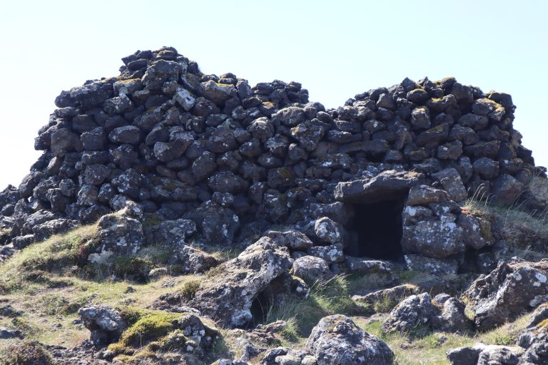
There are over 200 ancient huts, called fish storage huts, on the edge of Bæjarhraun, above the main road, that were likely used to store and dry fish. The huts are top-built and fit very well into the lava landscape, so it’s difficult to spot them from the road.

Irish place names are common in the area, for example, Írskrabrunnur (The Well of the Irish). The well is 16 steps down to the water. It was lost for several decades but was found again in 1989 and was cleaned.

Hiking trails at this resort
Hólastígur – Móðulækur – Gufuskálar